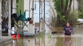
The National Weather Service of Louisville warns as much as three to five inches of rain could fall across Kentucky through early Saturday morning.
The wet weather has the potential to cause flash and river flooding across the state. Weather officials say wind gusts up to 55 miles per hour are possible Friday afternoon, with higher gusts possible in eastern Kentucky and southern Indiana. The winds and rains are already knocking down trees and branches, causing power outages.
As of 5:00 p.m. on Friday, about 225,000 homes were without power, many east of the I-75 corridor. That's about 15% of all Kentucky households, based on 2020 U.S. Census data.
A spokesperson for Kentucky Emergency Management confirmed that, despite ongoing high winds and downed trees causing power outages, the agency had no requests for state assistance as of Friday afternoon. They reported that some local 911 centers lost power temporarily, but are all back online.
Several local governments in eastern Kentucky declared states of emergency including the counties of Boyd, Boyle, Breathitt, Carter, Clark, Clay, Greenup, Lee, Letcher, Magoffin, Menifee, Morgan and Wolfe. Cities in the region also declared emergencies including Ashland, Catlettsburg, Clay City, the city of Greenup and Winchester.

“Our major concern is how big these wind gusts can get,” Kentucky Governor Andy Beshear said in a weather update Friday morning. “Our two big issues are wind and rain.”
“We are pretty dry right now which means we can take a lot of rain, but this is a whole lot of rain,” Beshear said, citing drought conditions before Helene arrived.

Several flood gauges on the Cumberland River in the southeastern corner of Kentucky are predicting “action level” water levels in local rivers, some just below minor flooding.
Harlan County emergency management posted on Facebook Friday morning that “river levels are up some, but there is still room to handle more water.” They say their biggest concern is for roadways covered in water, downed trees and mud slides.
Harlan County Judge Executive Dan Mosley posted that trees have fallen through at least three homes near Evarts and one person is being treated for injuries.
It’s also possible that minor river flooding could develop along the Lower Green River.
State employees were sent home at 10:30 a.m. on Friday as Governor Andy Beshear said he expects impacts to road conditions from rain and high winds to be the worst around noon on Friday.
The University of Louisville and Jefferson County Public Schools, the largest school district in Kentucky, closed on Friday out of caution. Other universities across Kentucky are still operating on a normal schedule, but said they are closely monitoring weather conditions.
Beshear said it’s too early to direct resources to other states, but he may send aid to places like Florida or North Carolina when the situation resolves.
“Folks came to help us, we want to be there to help them,” Beshear said, acknowledging the aid that came during previous disasters in Kentucky.
The extended period of rainfall is likely to cause flash flooding in areas across the state. Officials are warning drivers to avoid crossing standing water, and take precautions as they travel.


